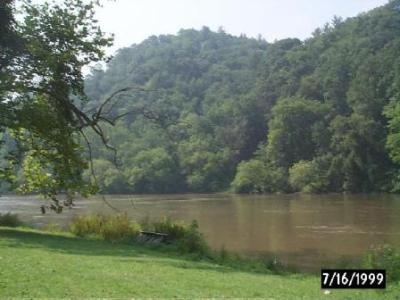
Broad River Fishing Spot
- Elevation: 538'
- Last Modified By: vinny60 on 09/08/09 01:20 PM
- Ask about Broad River in our Fishing Forums
Photos
Fish Species
Broad River Description
The Broad River is, along with the Chattooga, one of the major northern tributaries of the Savannah River. With 50 miles of navigable river from its inception to Thurmond Lake, the Broad offers nearly year-round opportunities for canoeing and camping except in periods of extreme drought. The 6 miles of river in the upper section contain most of the river’s rapids. In the lower section, the Broad becomes a pastoral stream eminently suited for beginning canoeists and those desiring a relaxed canoe-camping experience. Locals consider the Broad to start at the confluence of its two largest tributaries: the Middle Fork Broad and Hudson Rivers. For those interested in floating the entire length of the Broad River US 29 provides access to both of these rivers upstream of the confluence. The Broad River is among the last free-flowing rivers in Georgia. It flows south from its headwaters in Banks and Stephens Counties through Madison and Elbert Counties to its confluence with the Savannah River at the Clarks Hill/Strom Thurmond Reservoir. The Broad River is critical to the health and economic well-being of the citizens of northeast Georgia. It provides drinking water for the cities of Royston and Franklin Springs and it is an industrial and agricultural water supply for the region. The river provides residents with a wealth of recreational activities including canoeing. The river provides residents with an array of recreational activities including boating and fishing. The river supports a variety of fish including bass, catfish, and as of last year the robust redhorse. Currently public access to the river is quite limited.
The Broad River is a major tributary of the Savannah River in northeastern Georgia. The North Fork of the Broad River begins in the foothills of the Appalachian Mountains in Stephens County, then joins the Hudson River flowing out of Banks County, Georgia. The North Fork Broad River then becomes the county line of Madison and Elbert counties as it circulates southeast. As the North Fork Broad River flows by Carlton, Georgia, it merges with the South Fork Broad River at the junction of Oglethorpe, Madison & Elbert Counties where thereafter it becomes exclusively "The Broad River" and continues its flow uninterupted toward the Savannah, passing Elbert County to the north, Oglethorpe, Wilkes and Lincoln counties to the south. Prior to merging with the North Fork Broad River the South Fork Broad River originates west at Minish's lake near Danielsville, Georgia and passes through Watson Mill Bridge State Park also which borders Oglethorpe and Madison counties. Most of the Broad River's course runs across the Piedmont Plateau, ending where it flows into the Savannah River in what is now innundated by the Strom Thurmond Reservoir, U.S.C.O.E. in Elbert County. It remains one of the the least developed watersheds in the Georgia Piedmont.[1]